TECHNOLOGY

US uses geological mapping to shape critical minerals strategy

Supported by IIJA funding, the Survey is using advanced mapping to locate strategic commodities

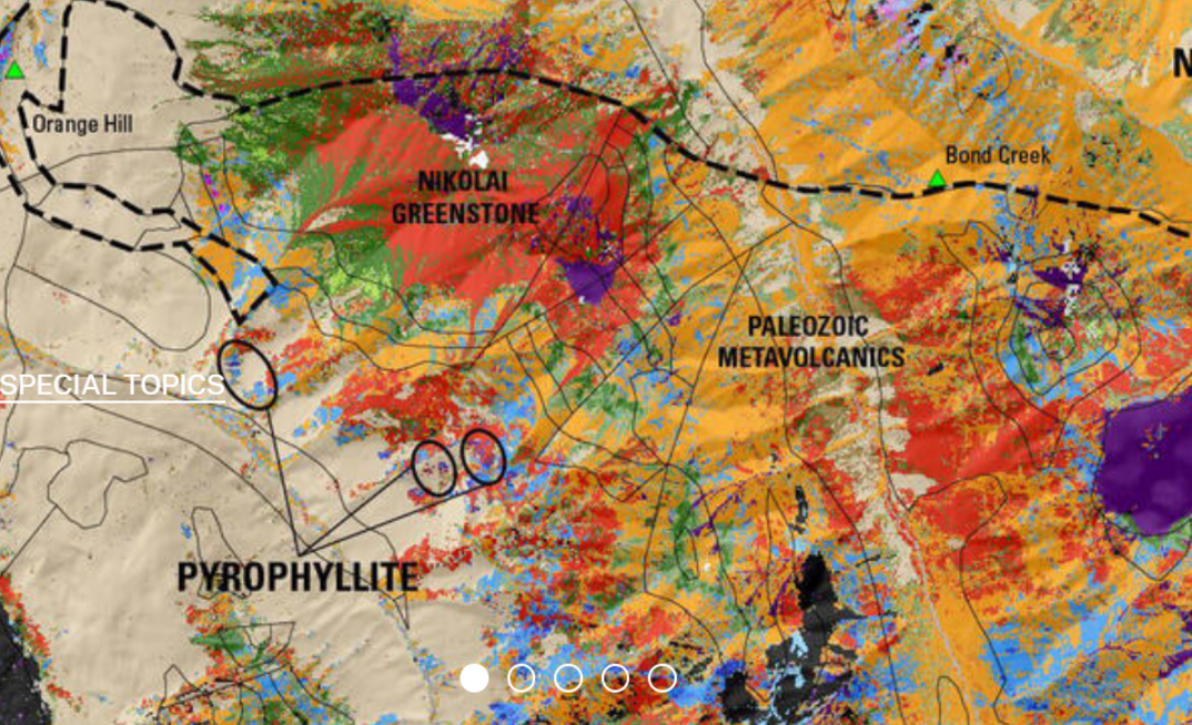
Data acquired under Earth MRI includes state-of-the-art geologic maps, large geophysical surveys, and topographic lidar surveys. Photo: USGS

Data acquired under Earth MRI includes state-of-the-art geologic maps, large geophysical surveys, and topographic lidar surveys. Photo: USGS

A report released by the US Congressional Research Service on Friday has shed light on how the country is using its Geological Survey (USGS) to address supply concerns for minerals deemed 'critical' to...

Start a free trial to continue reading this article

Already have an account?

Subscribe now

A growing series of reports, each focused on a key discussion point for the mining sector, brought to you by the Mining Magazine Intelligence team.

A growing series of reports, each focused on a key discussion point for the mining sector, brought to you by the Mining Magazine Intelligence team.

editions

Mining Magazine Intelligence Exploration Report 2024 (feat. Opaxe data)

A comprehensive review of exploration trends and technologies, highlighting the best intercepts and discoveries and the latest initial resource estimates.

editions

Mining Magazine Intelligence Future Fleets Report 2024

The report paints a picture of the equipment landscape and includes detailed profiles of mines that are employing these fleets

editions

Mining Magazine Intelligence Digitalisation Report 2023

An in-depth review of operations that use digitalisation technology to drive improvements across all areas of mining production

editions

Mining Magazine Intelligence Automation Report 2023

An in-depth review of operations using autonomous solutions in every region and sector, including analysis of the factors driving investment decisions